SOUTH VICTORIA DOCK RD & RIVERSIDE ESPLANADE
PROJECT STAGES
The proposal for the Waterfront region of Dundee was built on a macro-micro strategy, investigating the current issues and strengths of the site to develop a situation-specific solution.
research & analysis
This stage largely consisted of initial site visits and desktop studies, collecting a mixture of primary and secondary research. We then expanded on these observations to identify the key struggles of the current site and what scale of intervention would be required to resolve each issue.

Macro strategy
This second stage involved creating a holistic approach to our site interventions. This enforced a more fluid and cohesive group dynamic that ensured there was rational reasoning behind every key move.

micro strategies
This conclusive stage divided the Waterfront site into 6 key aspects or areas to individually investigate in more depth.
SITE INTRODUCTION

The City of Dundee is located on Scotland's East Coast and is home to 45,000 people.
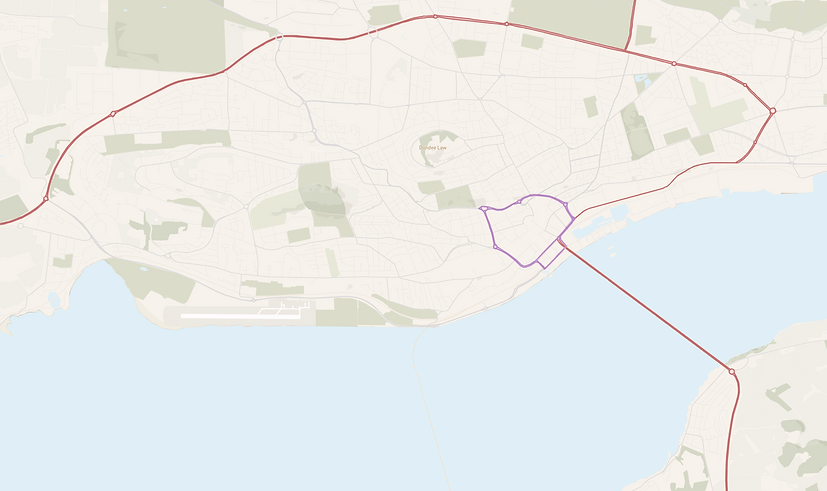
Inner Ring Road
Outer Ring Road (Kingsway)
The city has 2 main ring road infrastructures that facilitate easier travel through Dundee and onto major roads. The outer ring road leads West to Perth/Glasgow and North to Aberdeen. The Tay Road Bridge acts as the main access point to Fife, without which you must travel around the River Tay through Perth.

Explored Site
The project site is located on the southern edge of the city, bordering the River Tay.

Dundee City Centre
The site is directly intertwined with the Dundee City Centre and the Inner Ring Road. (Highlighted in Brown) The Tay Road Bridge passes through the site to connect to this ring road.

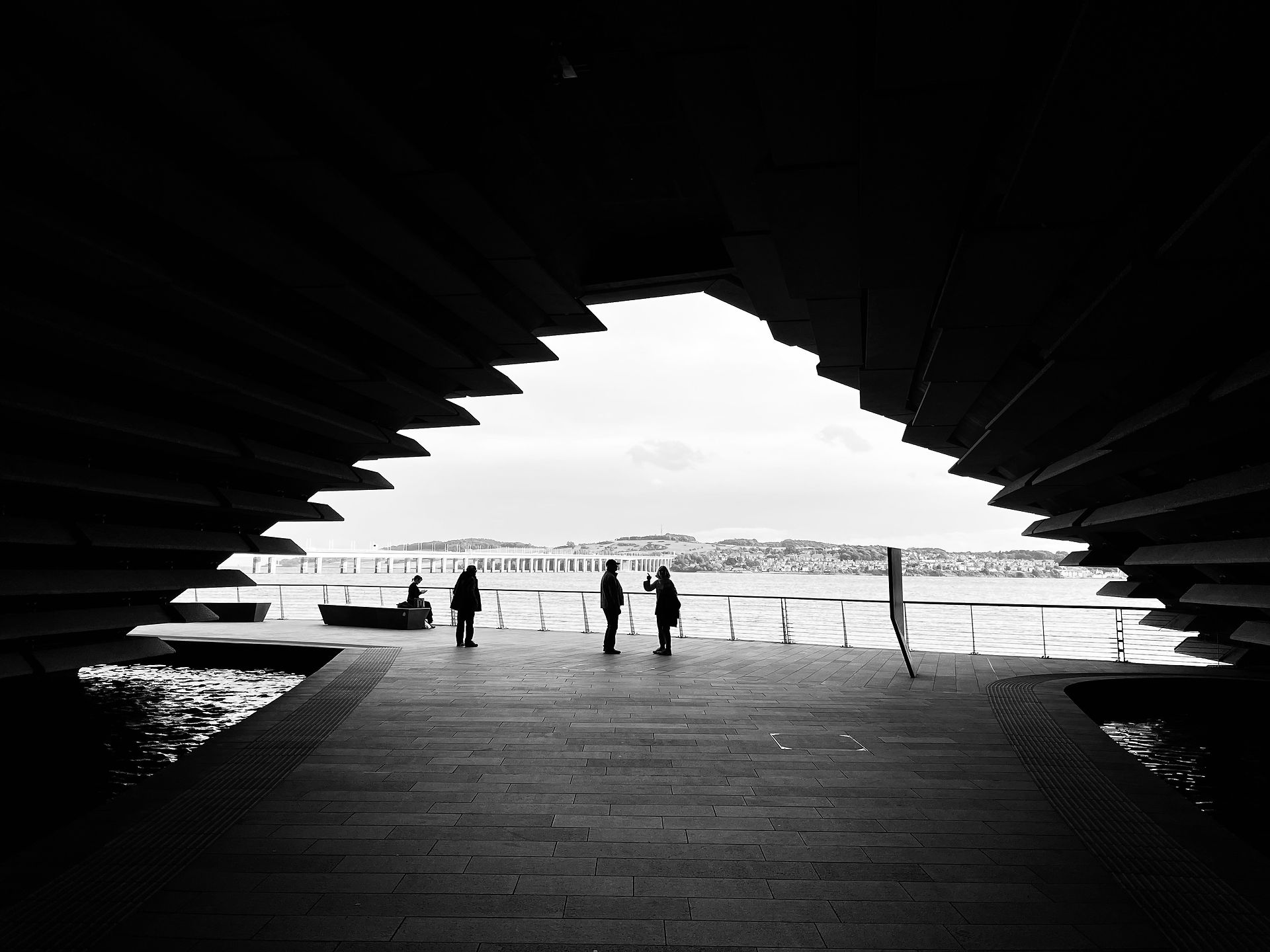
Riverside Esplanade
South Victoria Dock Road
The road is split into two main parts – the older two-lane South Victoria Dock Road and the wider four-lane Riverside Esplanade built in 2013 to accommodate the new Bridge ramp layout. South Victoria Dock Road is utilized primarily by residents of the City Quay area whereas Riverside Esplanade forms a connection between two A-class roads.
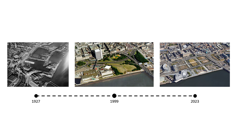
The current site lies on what used to be Dundee's central docks, however as the trade industry dwindled the docks became underused and collected with silt, until they were finally filled in. In 1964 the Tay Road Bridge was completed; it's exit and entry ramps occupying a vast amount of space on Dundee's waterfront as seen the 1999 aerial image above. In 2013 the bridge ramps and nearby waterfront buildings were demolished and replaced by a more space-saving grid solution.